AboutEnterprise solutionsGet the app
Free walking tour · Kreuzberg · Berlin

Walk Kreuzberg,
your way.

Free Kreuzberg walking tour - Görli, Markthalle Neun, the canal, Oberbaumbrücke, in 30 seconds

Your free walking tour of Berlin's alternative heart - Görlitzer Park, Markthalle Neun (Street Food Thursday is the city's foodie ritual), the Landwehrkanal towpath, the 1894 Oberbaumbrücke, the Bergmannkiez, Kottbusser Tor, Mehringdamm currywurst (Curry 36), the SO36 club, the Jewish Museum. Pick a walk below or tell us a theme. Works offline, 9 voiced languages, 30 free minutes on signup.

Or pick your walk

Local knowledge

What we'd tell you on day one

Six things that change how you walk Kreuzberg.

01

Thursday is Street Food Thursday at Markthalle Neun.

Every Thursday 17:00-22:00 the 1891 Markthalle Neun (Eisenbahnstrasse 42-43, between Lausitzer Platz and Görlitzer Park) hosts about 40 rotating international street-food stalls plus 10-15 craft-beer and natural-wine taps. The cuisine is genuinely international - Vietnamese banh mi, Sicilian arancini, Argentine empanadas, Korean fried chicken, Mexican carnitas, Polish pierogi - changing weekly. Entry is free, paying is cashless (mobile/card), portions are €5-12 each. Arrive at 17:00 to walk the hall before the queue builds; the place is heaving by 19:30 and starts to clear after 21:00. The neighbouring streets (Lausitzer Strasse, Reichenberger Strasse) hold Berlin's most-quoted new restaurants - Lode & Stijn (Michelin), Hallmann & Klee - if you want a sit-down dinner after the market. Sunday at the same hall is the "Breakfast Market" (10:00-17:00) for brunch-only stalls.

02

Görli is the Sunday Kreuzberg ritual.

Görlitzer Park (12.5 hectares between Wiener Strasse and Görlitzer Strasse) is the central Kreuzberg public space - the meadow, the basketball courts, the playgrounds, the dog park, the social-democratic Sunday picnic-and-barbecue tradition. Locals bring blankets, beer, charcoal grills (legally permitted in the marked zones), Turkish-cousin family parties cook full meals, sound systems pop up, the meadow fills with several thousand people on warm Sundays. Görli is also Berlin's most-publicised open drug market - dealers operate openly along the main path, and the surrounding social problems are real. Tourist safety is generally fine in daylight; watch your phone, don't engage with people offering you anything, and stay on the open meadow rather than wandering the wooded edges after dark. The park is at its best on summer evenings (sunset 22:00 in June) - bring a beer from a nearby Späti, find a spot, sit through the golden hour.

03

The Tuesday/Friday Türkenmarkt at Maybachufer.

The Tuesday and Friday Türkenmarkt at Maybachufer (the canal-side street, Kottbusser Brücke to Schinkestrasse, 11:00-18:30) is the iconic Kreuzberg market - 50-70 stalls of Turkish + Middle Eastern + biological produce: olives, cheeses, breads, fresh herbs, vegetables, fish, fabrics, household goods. The market is the canonical immigrant-Berlin shopping experience - Turkish-language haggling, free-tasting at most stalls, bulk-buy prices for the locals doing their week's shopping. The canal-side location makes it visually distinctive - tree-lined towpath, barges passing, the elevated U-Bahn viaduct nearby. Combine with a Sunday Nowkölln Flowmarkt at the same Maybachufer location (vintage + design, 10:00-17:00, every second Sunday) and the eastern Maybachufer brunch cafés (Café Tier, Five Elephant) for a full canal-side morning.

04

Curry 36 + Mustafa's = the canonical Mehringdamm meal.

The 50-metre stretch of Mehringdamm between Mehringdamm U-Bahn and Yorckstrasse holds Berlin's two most-iconic fast-food institutions, 4 metres apart. Curry 36 (Mehringdamm 36, since 1981) is the canonical Berlin currywurst stand - €3.10 for a curry-with-skin (mit Darm), €1.80 a portion of fries, queue 5-10 minutes off-peak, 15-25 minutes at lunch/dinner. Mustafa's Gemüse Kebab (Mehringdamm 32, since 2004) is the canonical doner queue - the genuinely-vegetarian-with-meat option (grilled vegetables + halloumi + lamb in fresh flatbread) that started the Berlin gourmet-doner trend. Queue 30 minutes to 90 minutes depending on the day - cash only, €5.50, worth the wait but if you're hungry get the Curry 36 first. Both stands cash-only, no seating - eat standing on Mehringdamm and watch the U-Bahn pull in and out of the elevated station above.

05

The Wall ran along Kreuzberg's northern and eastern edges.

From 13 August 1961 to 9 November 1989 the Berlin Wall ran along the northern and eastern edges of Kreuzberg. The "Wall" was actually two parallel walls with a death strip between - the inner Wall on the East Berlin side, the outer Wall (the famous painted-on-the-west-side one) on the West Berlin side, and the cleared zone with guard towers and dog patrols in between. Kreuzberg's Wall sections: along Niederkirchnerstrasse from the Topography of Terror past Checkpoint Charlie (1.5 km west); along Engeldamm and Bethaniendamm (the western and eastern edges of the Kreuzberg-Mitte border); along Köpenicker Strasse and Schlesische Strasse to the Spree at Schlesisches Tor; then across the Spree at the Oberbaumbrücke (the Wall crossed the river here at the Cuvrystrasse/Oberbaumstrasse corner). The line is marked through Kreuzberg by the double cobblestone strip set into the pavement with "Berliner Mauer 1961-1989" inscribed. Best Wall sites near Kreuzberg: Topography of Terror (Niederkirchnerstrasse 8, free, daily 10:00-20:00 - the former Gestapo headquarters with a preserved Wall section); the Berlin Wall Memorial at Bernauer Strasse (2.5 km north).

06

Kreuzberg has 36 and 61 - the postal-code divide.

"Kreuzberg 36" (SO36) is the eastern half of Kreuzberg - the Wall-edge, Turkish-immigration, punk-and-squatter half, postal code 10999 (formerly 1000-Berlin-36). "Kreuzberg 61" is the western half - the leafy Bergmannkiez bourgeois half, postal code 10961-10967 (formerly 1000-Berlin-61). The distinction has been a Kreuzberg in-joke for 60 years - "SO36" was the Cold War postal code "South-East 36", the part right against the Wall; "61" was the calmer west. The legendary punk-rock club SO36 (Oranienstrasse 190, since 1978, where Iggy Pop, Wire, Einstürzende Neubauten and the early Nick Cave played) is the symbolic heart of SO36 culture. The contemporary divide is softer - both halves are heavily gentrified - but the eastern Wrangelkiez and the western Bergmannkiez still feel distinctly different. Walk SO36 for the Oranienstrasse + Görli + canal Kreuzberg; walk 61 for Bergmannstrasse + Chamissoplatz + the leafy bourgeois face.

How it works

How iWander walks Kreuzberg with you.

Three things, in 30 seconds.

iWander home screen

01

Type your walk.

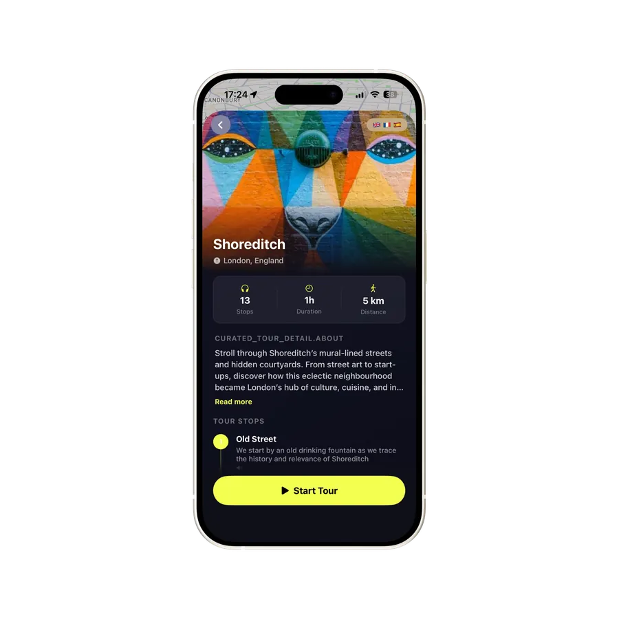
Any sight, theme or vibe. "Kreuzberg essentials - Kotti to Markthalle to Oberbaumbrücke", "Görli on a Sunday afternoon", "Street Food Thursday at Markthalle Neun", "Türkenmarkt Tuesday morning", "Curry 36 + Mustafa's + Hennes for a beer", "SO36 punk history - the Oranienstrasse club scene". iWander writes you the walk in 30 seconds.

iWander audio walk in progress

02

Hear the story as you walk.

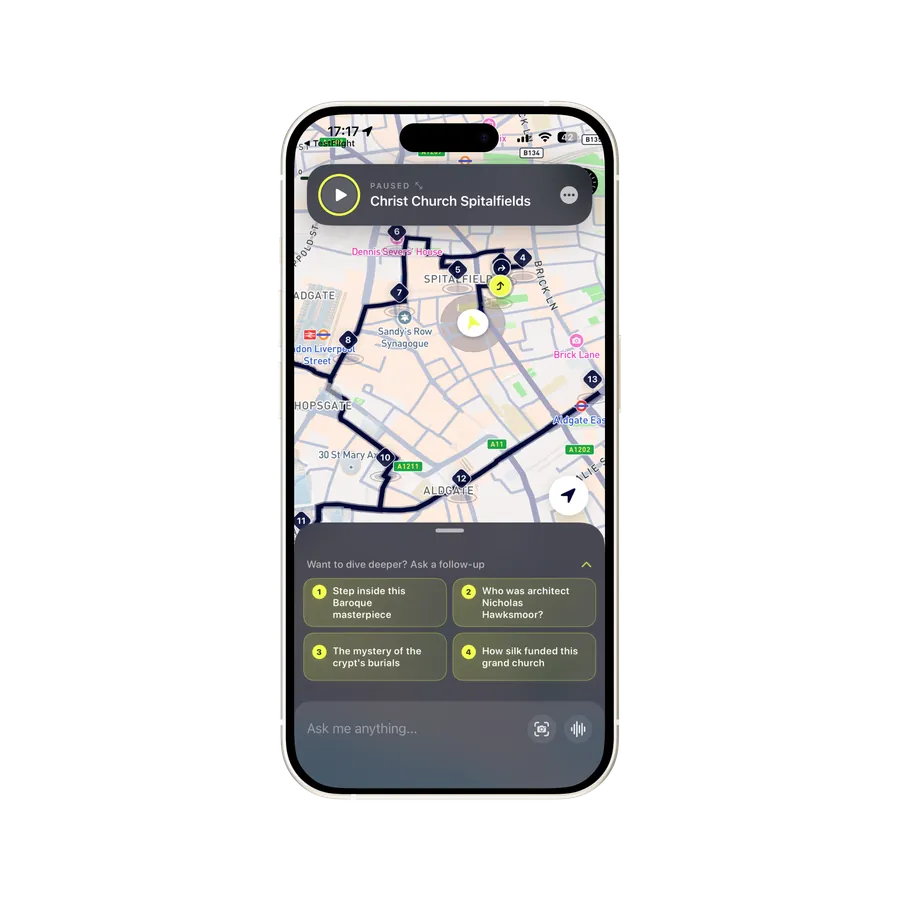
The 1845-1850 building of the Landwehrkanal, the 1845-1891 expansion of Kreuzberg under the Wilhelmine boom, the 1907 opening of Hennes Gasthaus, the 1919 murder of Rosa Luxemburg in the canal, the 1933 Nazi seizure of Kreuzberg (the SA brownshirts came from here), the WWII bombing destruction, the post-war working-class West Berlin, the 1961 Wall arriving on Kreuzberg's edge, the 1960s-70s Turkish guest-worker immigration, the 1980s punk and squatter scene, the 1989 Wall fall, the post-2000 gentrification.

iWander on-demand AI guide

03

Ask anything along the way.

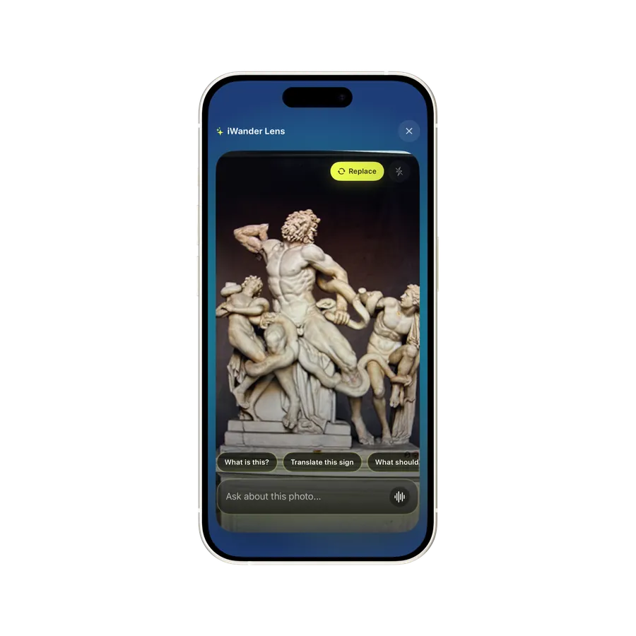
What's currywurst made of? Where's the SO36 club? What's the Türkenmarkt day? When did the Wall come down on this street? Point your camera, ask out loud, or type. Your guide answers in seconds.

Works offline · 9 voiced languages · 30 free minutes on signup

What makes it worth walking

From Wilhelmine working-class district to Cold War dead end to immigrant centre to gentrified foodie magnet - 160 years on a triangle of canal, river and U-Bahn

Kreuzberg is Berlin's most-quoted alternative neighbourhood and the cultural-immigration core of the city. The district is a triangle bounded by the Landwehrkanal (north), the Spree River (north-east), and the inner elevated U1 line - about 10 sq km, 160,000 residents, the densest population concentration in central Berlin. Kreuzberg was built as a working-class Wilhelmine district between 1850 and 1900, became a Cold War dead end against the Berlin Wall from 1961 to 1989, attracted the Turkish guest-worker (Gastarbeiter) immigration of the 1960s-1980s and the West German squatter and punk scene of the 1970s-1990s, and from the 2000s gentrified into the city's centre of foodie restaurants, design boutiques and rising rents. Walking Kreuzberg is walking 160 years of urban social history - the Wilhelmine red-brick tenements, the WWII bombing scars, the Turkish-German signage, the squatter graffiti, the Markthalle Neun foodie crowd - layered on a single dense walking grid.

The Wilhelmine working-class district

Kreuzberg was built in the second half of the 19th century during the Wilhelmine industrial boom. The neighbourhood is named for the small Kreuzberg hill (66 metres high - the highest natural elevation in central Berlin) in Viktoriapark, with the 1821 Schinkel-designed cast-iron National Monument to the Wars of Liberation (the iron cross at the summit is what gives the district its name - "Kreuz-Berg" = "Cross Hill"). The district was developed 1850-1900 as a dense working-class quarter for the rapidly-expanding industrial city - the Mietskasernen (rental barracks) housing the workers of the engineering, machine-tool, and railway industries that built modern Berlin. The street grid is regular, the buildings are 5-6 storeys, the courtyards are deep (each tenement block has 2-4 inner courtyards). The Landwehrkanal (1845-1850 by Peter Joseph Lenné) was built as the freight artery moving coal and iron through the district; the Görlitzer Bahnhof (built 1865-1867, bombed 1945, decommissioned 1962) was the main railway station serving the eastern destinations.

The neighbourhood was almost entirely working-class through the late 19th and early 20th century. The Bergmannkiez (the leafy western Kreuzberg around Bergmannstrasse) was the only middle-class area; the rest was workers' housing. The 1919 January Uprising and the murder of Rosa Luxemburg (her body was dumped in the Landwehrkanal at the Lichtenstein Bridge by Freikorps soldiers - a small memorial plaque marks the location) made Kreuzberg an emblem of the failed Communist revolution in Germany.

WWII destruction and post-war working-class West Berlin

The 1940-1945 Allied bombing campaign destroyed about half of Kreuzberg's building stock - the central and eastern parts were particularly hard-hit. The post-war reconstruction was uneven. Kreuzberg was in the American sector after 1945 and the western part of divided Berlin from 1949 onwards. The eastern edge of the district (along the Engeldamm-Bethaniendamm-Köpenicker Strasse line) became the Berlin Wall on 13 August 1961 - Kreuzberg sat right against the Wall, looking across at East Berlin (Mitte) on the other side. The Wall position made Kreuzberg a Cold War dead end - cheap rents, no through-traffic, the working-class population progressively ageing and shrinking. From the 1960s onwards the West German government recruited "Gastarbeiter" (guest workers) from Turkey, Yugoslavia, Italy, Greece, Spain and Portugal to fill the industrial labour shortage; the Turkish workers settled disproportionately in Kreuzberg because of the cheap rents, the proximity to the engineering employers, and the social network effect (one Turkish family attracts the next). By 1980 Kreuzberg was the largest Turkish population centre outside Turkey - about 40,000 Turkish residents in a district of 150,000.

The squatter and punk decade

The 1970s and 1980s were Kreuzberg's countercultural high point. The combination of cheap rents, abandoned buildings (the empty tenements scheduled for demolition that the city never got round to), the Wall-edge dead-end character, and the West German anti-establishment student left created a unique squatter scene. By 1981 there were about 165 squatted buildings ("besetzte Häuser") in Kreuzberg - mostly along Oranienstrasse, Manteuffelstrasse, Mariannenplatz, the streets immediately west of the Wall. The 1980 squatter movement coincided with the punk-rock scene at the SO36 club (Oranienstrasse 190, since 1978) where Iggy Pop, Wire, Einstürzende Neubauten and the early Nick Cave played; with the Tuntenhaus collective at Mariannenplatz; with the political-left occupation of the Kreuzberg Bethanien hospital site. The 1 May 1987 May Day riots ("Kreuzberger Krawalle") were the high point of the political confrontation - several days of street battles between squatters and police along Oranienstrasse and Mariannenplatz. The May Day Kreuzberg tradition continues - the annual MyFest at Mariannenplatz (1 May, free, music + food + speeches) commemorates the squatter heritage.

The 1989 fall of the Wall transformed Kreuzberg overnight from a Cold War dead end to a central neighbourhood. The Wall along the eastern edge of Kreuzberg was the first major Wall section dismantled (November-December 1989). Cross-Wall traffic resumed; new development pressure built up; the squatter buildings were progressively legalised (most of the squatters bought their buildings in cooperative form between 1990 and 2000, securing long-term ownership). The Turkish-German community remained the demographic majority but ageing; new German residents moved in from the late 1990s onwards.

The 2000s gentrification

The 2000s saw Kreuzberg's gentrification accelerate. The combination of the central location (suddenly central with reunification), the architectural fabric (the surviving Wilhelmine tenements with high ceilings and tall windows that are universally desirable urban property), the cultural cachet (Berlin's most-mentioned neighbourhood), and the wave of professionals working in the new Berlin tech and creative sectors drove rents up sharply - approximately 4x over 2005-2025. The Turkish-German community has been progressively displaced, retiring in place to their cooperative apartments, gradually outnumbered by the new gentrifier population. The squatter buildings have been legalised and turned into co-ops. The new restaurants, design boutiques, third-wave coffee shops and natural-wine bars have replaced the old Turkish bakeries and old-Berlin Kneipen.

The cultural balance has shifted but not collapsed. The Turkish community is still demographically central (about 25% of Kreuzberg's population is Turkish-German), the Turkish bakeries and supermarkets along Adalbertstrasse and Kottbusser Damm still function as the community's commercial spine, the Tuesday/Friday Türkenmarkt at Maybachufer is the canonical Turkish-Berlin market. The squatter heritage is preserved in the legalised buildings, the political graffiti, the May Day tradition, the SO36 club. The new layer - Markthalle Neun, the Reichenberger Strasse restaurants, the design boutiques along Oranienstrasse - sits on top of the old layer rather than replacing it. Walking Kreuzberg you see the layers superimposed - a Turkish supermarket next to a Michelin-star restaurant, a punk-graffitied wall behind a third-wave coffee shop, the 1894 Markthalle Neun hosting a Korean street-food stall.

The contemporary walking experience

The Kreuzberg of 2026 is the densest walking experience in central Berlin. Walk east-to-west from the Oberbaumbrücke (the iconic 1894 bridge to Friedrichshain) along Schlesische Strasse and Wrangelstrasse to Görlitzer Park; cross the park, continue along Wiener Strasse to Lausitzer Platz and Markthalle Neun; loop south to the Landwehrkanal and follow the Maybachufer west to Kottbusser Tor; descend through Oranienstrasse (the alternative-Kreuzberg axis with the SO36 club, the Tuntenhaus, the squatter buildings) to Heinrichplatz; continue west to Hallesches Tor and the Jewish Museum; finish at Mehringdamm with Curry 36 and Mustafa's. The east-to-west walk is about 4.5 km and takes 3-4 hours with stops; the cross-section through 160 years of Kreuzberg history is denser than any other comparable distance in central Berlin.

The Bergmannkiez (the western leafy half) is a separate sub-walk - Bergmannstrasse east-to-west from Mehringdamm to Südstern, with Chamissoplatz, the Riehmers Hofgarten, the Marheineke Markthalle, the Viktoriapark hill (with the Kreuzberg cross at the top, the view back over central Berlin). The Bergmannkiez walk is quieter, calmer, more middle-class - a useful contrast to the SO36 frenzy. Together the SO36 walk + Bergmannkiez walk give a complete reading of Kreuzberg.
Questions

Frequently asked

Berlin's most-quoted alternative neighbourhood and cultural-immigration core. Bounded by the Landwehrkanal, the Spree and the inner U1 line. A working-class West Berlin district at the dead end of the Cold War 1961-89, then the centre of Turkish-German immigration and the squatter / punk scene. Now heavily gentrified but still grungy. The best food scene in central Berlin.
A focused walk - Kottbusser Tor, Oranienstrasse, Görli, the canal, Markthalle Neun, the Oberbaumbrücke, Bergmannstrasse - takes 3 to 3.5 hours. East-to-west is about 4.5 km. Best Thursday for Street Food Thursday at Markthalle Neun, Tuesday/Friday for the Türkenmarkt, sunny Sundays for Görli.
'Görli' to locals. The 12.5-hectare park on the former Görlitzer Bahnhof rail yard, landscaped 1990s. The iconic Kreuzberg social space - meadow, basketball courts, dog park, Sunday picnics. Also Berlin's most-publicised open drug market - dealers operate on the main path. Best summer evenings, watch your phone, stay on the open meadow after dark.
Eisenbahnstrasse 42-43. 1891 Wilhelmine market hall rescued from a discount-supermarket takeover by a 2010-11 community initiative. Permanent traders Tue-Sat 09:00-22:00. Street Food Thursday 17:00-22:00 - about 40 rotating international stalls plus craft beer, the city's foodie ritual. Also Cheese Berlin, Pasta Berlin, Wurst Markt.
The 10.7-km artificial canal built 1845-1850 by Peter Joseph Lenné. Kreuzberg's northern edge. The tree-lined Paul-Lincke-Ufer (north) and Maybachufer (south) are the most picturesque walks. The 1919 murder of Rosa Luxemburg - her body was dumped in the canal at the Lichtenstein Bridge. Tuesday/Friday Türkenmarkt at Maybachufer 11-18:30.
Oberbaumstrasse, the Kreuzberg-Friedrichshain border. Berlin's most-photographed bridge - 154 metres of double-deck red-brick neo-gothic, 1894-1896. U1/U3 elevated U-Bahn line above, road and footpath below. The southern East-West border crossing 1961-89. Iconic at sunset. East Side Gallery starts on the Friedrichshain side.
'Kotti' to locals. The central Kreuzberg U-Bahn intersection (U1/U3/U8). The 1970s NKZ social-housing complex (370 apartments around the elevated tracks), the symbolic centre of the Turkish-German community since the 1960s, the open drug-and-marginalised-people scene. Oranienstrasse runs east-west from Kotti with the SO36 punk club at number 190.
The leafy bourgeois sub-neighbourhood around Bergmannstrasse - the 1.2-km tree-lined high street between Mehringdamm and Südstern. Independent bookshops, vintage clothing, the Marheineke Markthalle (1892), Chamissoplatz (preserved late-19th-century square), the Riehmers Hofgarten (1881-99, five-courtyard residential ensemble). The quieter, middle-class face of Kreuzberg.
Currywurst at Curry 36 (Mehringdamm 36, cash only). Döner at Mustafa's Gemüse Kebab (Mehringdamm 32, 30-90 min queue). Classic Berlin: Henne (since 1907, roast chicken + clay-mug beer); Max und Moritz. Modern: Lode & Stijn (Michelin); Hallmann & Klee. Markthalle Neun Street Food Thursday. Bergmannstrasse for the Kiez-Café standard.
Lindenstrasse 9-14. The 1999-2001 Daniel Libeskind deconstructivist zinc-clad building shaped like a fractured Star of David. Tells the 2,000-year story of Jewish life in Germany. The architecture is the equal subject - the voids, the Garden of Exile (49 tilted concrete pillars), the Memory Void with Kadishman's 10,000 iron faces, the Holocaust Tower. €10, daily 10:00-19:00 (closed Mon).
U-Bahn: U1/U3 elevated line (Schlesisches Tor, Görlitzer Bahnhof, Kottbusser Tor, Hallesches Tor); U8 (Kottbusser Tor); U6 (Mehringdamm); U7 (Möckernbrücke, Mehringdamm, Südstern). From Hauptbahnhof: 10-15 min via Hallesches Tor. From Mitte: 15-20 min walk south. Ostbahnhof S-Bahn is across the Spree - cross the Oberbaumbrücke.

How to find it

Getting to Kreuzberg

District
Friedrichshain-Kreuzberg borough · postal codes 10961-10999
U-Bahn
U1/U3 elevated (Schlesisches Tor, Görlitzer Bahnhof, Kottbusser Tor, Prinzenstrasse, Hallesches Tor) · U8 (Kottbusser Tor) · U6 (Mehringdamm) · U7 (Möckernbrücke, Mehringdamm, Südstern)
S-Bahn
Ostbahnhof (across the Spree in Friedrichshain - walk south over Oberbaumbrücke) · Anhalter Bahnhof (north-west edge near Topography of Terror)
From Brandenburg airport (BER)
FEX or RE7 to Ostkreuz then S-Bahn west to Ostbahnhof (40 min total) · or U7 from Rudow to Mehringdamm (45 min)
Walking from Mitte
15-20 minutes south via Friedrichstrasse → Hallesches Tor → Mehringdamm
Best season
May-September for outdoor Görli + canal-side culture. Türkenmarkt year-round. November-February cold but Markthalle Neun is indoor and great any season
When to walk
Markthalle Neun Tue-Sat 09-22 (closed Sun-Mon). Street Food Thursday 17-22. Sunday Breakfast Market 10-17. Türkenmarkt Tue + Fri 11-18:30. Görli at its best summer evenings (sunset 22:00 in June). Jewish Museum Tue-Sun 10-19, closed Mon

The headline sights

Three landmarks to anchor your walk

Pull the audio walk around any of these and the rest of Kreuzberg falls into place.

Markthalle Neun + Görlitzer Park

Eisenbahnstrasse 42-43 + Wiener Strasse. The 1891 Markthalle Neun (one of the original 14 Wilhelmine market halls of Berlin) is the canonical Kreuzberg food destination - Street Food Thursday (17-22) is the city's most-quoted foodie ritual, with about 40 rotating international stalls and 10-15 craft beers. Görlitzer Park (300m east) is the social-democratic Sunday Kreuzberg meadow built on the former Görlitzer Bahnhof rail yard. The two together define modern foodie Kreuzberg.

Walk Markthalle + Görli

Oberbaumbrücke + the Landwehrkanal

Oberbaumstrasse + Paul-Lincke-Ufer. Berlin's most-photographed bridge - the 154-metre double-deck 1894 red-brick neo-gothic Oberbaumbrücke over the Spree, the U1 elevated line above and the road below, the East-West border crossing 1961-89. The Landwehrkanal (1845-50) forms Kreuzberg's leafy northern edge with the Paul-Lincke-Ufer and Maybachufer towpaths, the Tuesday/Friday Türkenmarkt, and the canal-side cafés. Together they frame the north of Kreuzberg.

Walk the bridge + canal

Kottbusser Tor + Oranienstrasse

Adalbertstrasse + Oranienstrasse. 'Kotti' is the central Kreuzberg U-Bahn intersection (U1/U3/U8 meeting under the elevated viaduct), with the 1970s NKZ social-housing complex and the symbolic centre of the Turkish-German community. Oranienstrasse is the historic alternative-Kreuzberg axis east of Kotti - the SO36 punk club (number 190, since 1978), the May Day riot zone, the squatter Kreuzberg heritage. Together they hold the cultural-political core of the district.

Walk Kotti + Oranienstrasse

Other Berlin neighbourhoods to wander

Walk somewhere else in Berlin

Build any Kreuzberg walk you want.

Tell us a theme, a question, a vibe - Street Food Thursday at Markthalle Neun, Görli on a Sunday afternoon, the Türkenmarkt at Maybachufer, the Oberbaumbrücke at sunset, the SO36 punk-club crawl, Curry 36 + Mustafa's + Hennes - and your walk is ready in 30 seconds.

Get the iWander app

30 free minutes on signup · Subscriptions from $10/mo · Cancel anytime

Updated 22 May 2026 by the iWander local team · Curated for accuracy